Learn More about Settlement Systems
Settlement and heave can derail the best laid plans, especially in areas of geological instability and weak soil conditions where consolidation, ground settlement or other significant earth movement may occur. Nearby construction, excavation, or tunnelling can likewise disrupt ground stability. Ongoing measurement of settlement and/or heave is vital to ensuring the long-term stability of structures such as roadways, railways, embankments, rockfill dams, tailings dams, heap leach pads and landfills.
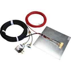
RST Instruments’ settlement systems are designed for long-term, cost-effective measurement of ground heave and settlement, and each has a specific but simple installation process suited to the installation environment and the needs of your project.
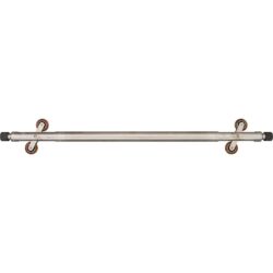
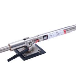
The Vibrating Wire Liquid Settlement System and the Precision Liquid Settlement Array are permanent installations that employ a network of sensors designed to detect changes in liquid pressure due to ground or structural settlement on a continual basis. The Digital Horizontal Inclinometer System, on the other hand, is a portable measurement tool that can be employed as needed at multiple sites by running the retractable inclinometer probe through a pre-installed horizontal casing below the ground surface.
RST also offers Magnetic Settlement Systems that measure ground settlement via a vertical column of magnets around pre-installed casing. These can be installed in a selection of three different configurations in soil and rock depending on the project requirements.
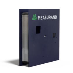
For monitoring of railroad track settlement/stability, RST offers either the use of the Digital Bus Track Monitoring System or the Measurand ShapeArray SAAX, both of which are mounted directly on to the track for biaxial profile measurements of the sensor chain.
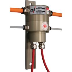
Whatever ground settlement and heave monitoring system is chosen for the project, a compatible RST Data Logger allows for reliable and precise data collection and integration along with suitable data visualization software such as GeoExplorer.