Learn more about GPS/GNSS sensors
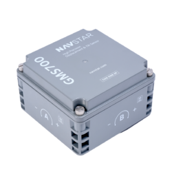
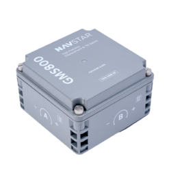
GPS/GNSS sensors (GMS700 and GMS800) can be rapidly deployed for three-dimensional displacement and tilt measurements. They are purpose-built for deformation monitoring in extreme climates and a variety of geospatial applications.
Displacement and tilt measurements from GPS/GNSS sensors can be used to determine the stability of a slope or the rate of ground shift, allowing for the assessment of the terrain stability in hazardous and unpredictable sites.
Real-Time Kinetic (RTK) GNSS processing is employed to deliver highly accurate deformation measurements. RTK is a type of GPS technology that uses a combination of GPS signals, a local Base Station, and one or more GNSS Rover units to provide highly accurate positioning data. Any errors that are present in the GPS data are corrected using satellite signals, resulting in highly precise positioning data.
The GPS/GNSS monitoring system consists of a local base station and one or more lightweight fibreglass-reinforced polyester cubic enclosures containing sensors that act as a rover, equipped with two antennas (one for terrestrial radio communication and the other for satellite reception). The rover units have built-in biaxial tiltmeters for dual-tilt quantification.
Raising the radio and GNSS antennas on a mast allows for effective system operation since signals are not interfered with by any obstructions, including power poles, trees, buildings, and rock faces.
A strong RTK Data Link reliably computes three-dimensional positions. The GNSS antenna on the Rover unit is the highest point of the installation and is secured permanently, ideally mounted on a strong metal pole with a concrete foundation. This ensures a clear, 360-degree view of the sky, 15 degrees and higher from the horizon.
For projects where ongoing or remote monitoring is required, the GPS.GNSS sensor monitoring system is a long-term installation solution available in two different power input options (battery-powered or solar) to accommodate the specific needs of your project within the installation environment.
GPS/GNSS sensors provide the following benefits to monitoring projects:
- Accurate three-dimensional displacement and tilt measurements.
- Line of sight not required.
- Ultra-low power consumption.
- No moving parts .
- Automated 24/7 monitoring.
- Rapid infield deployment.
- Flexible communications options.
- Proven reliability in extreme weather conditions.
- Sensors purpose built for slope monitoring.